Sunday, December 29, 2013

Raising a Glass

As we drove back to Central Pennsylvania I couldn't help but think of all the friendly folks that have helped me out already....and the project is barely off the ground.

A big thanks to....

Neal Hutcheson for all the great contacts, Rodney Snedecker and Linda Hall for all the wonderful information regarding previously recorded sites, Ranger Nicholas Larson for the keys to the forest, Ernestine Upchurch for all the information and for just being so awesome, James Knight for dropping everything and helping us out at the cabin, Johnny and Pat Burress, your kindness and willingness to help us out at the drop of a hat was instrumental, Clark Tires....a business I will return to with more busted trucks!, and definitely Ran Boytner and the Institute for Field Research for thinking this was a good idea.

Oh, and I can't forget the lovely Laurel, the archaeologist turned geneticist, who despite her love of cold weather was an amazing moonshine partner to have.  


Laurel and Ernestine getting ready to dance a jig at the Quilt House!

Friday, December 27, 2013

Johnny Burress, My New Hero


This was by far the most productive day.  We left for Johnny Burress’ house around 9am for our 10 o’clock meeting.  What a drive!  His gravel driveway is over a mile long and winds up through the mountains.  We arrive and meet Johnny and his wife Pat.  We sit in the living room for awhile getting to know each other.  At one point Johnny says he needs to go downstairs and make another sandwich because he didn’t know Laurel was coming.  The kindness these people show strangers is beyond me.

About 11am we climb in his Ford pickup and start driving along trails across his 300 acre property.  We drive to the edge, hop a barbed wire fence, and walk about 15 minutes to a small stream.  The location is about 100 meters from a large power line right-of-way (Figure 1 - location map coming soon).  Here we find our most complete still site.  There is a stacked stone furnace (Figures 2-3), metal pail (Figure 4), a barrel hoop, and dugout depressions were the barrels sat.  This site, SS-4JB, is a prime location for a future excavation.  Johnny tells us that he heard tale that it held a 100 gallon kettle and was in operation sometime in the late '50s early '60s.


Figure 1:  Location map (coming soon).


 Figure 2:  Horseshoe shaped stack of stones used for the still furnace.


 Figure 3:  Still furnace with one of the two metal rods used for structural support.


Figure 4:  Metal pail found on the streams edge.


Next we all went back to his house and had lunch.  About 1pm we set out for another still site that Mr. Burress knew about.  This one was off of Crawford Creek Road.  We had to park, walk around a locked gate, and hike up the road for about 15 minutes.  We then came to a branch off of Crawford Creek.  Before we walked up the trail along side this branch, Johnny pointed out were the moonshiner used to enter the area.  The edge of the creek where the water flows under the road has what looks like steps (or at least could serve as steps) (Figure 5).  He said this is where the moonshiner would enter the forest so as to not create a trail from the road and potentially be discovered by the revenue officer.


 Figure 5:  The moonshiners entrance to the still site.
Notice the stones on the far left that would serve as steps.


 We hike up the trail about ¼ mile and come to a cliff overhang.  Johnny is very disappointed because there is a giant tree that has fallen from atop the stone overhang, bringing with it stone and debris, and unfortunately covering up the still site (Figures 6-7).  I was curious as to if this was even the place, as there was nothing left.  So I looked down the steep incline for artifacts.  At the bottom of the hill, next to the stream I found a metal barrel hoop (Figure 8).  So, it looks like this was a still site after all (SS-5JB).  This is a great example of how quickly (approximately 50 years) a known site can disappear.


 Figure 6:  Tree fall from atop the cliff's edge.


Figure 7:  Tree fall landed directly on SS-5JB.


 Figure 8:  Barrel hoop from SS-5JB


We hiked back down the mountain and returned to the truck.  Johnny drove us back to his house and we exchanged a few stories with his wife, Pat.  Laurel and I said our goodbyes, promised to stay in touch, got in our Kia Cardboard, and drove to Asheville.  Again, we had a hard time finding a place to stay.  We ended up at the Clarion near the airport.  This was convenient since we needed to trade cars at National in the morning.

We went out for dinner at Pack’s Tavern and plan on another early night.


 Johnny Burress, a man's man

Thursday, December 26, 2013

Two Hours, Two Stills


We left the cabin around 9am and drove to Waynesville to deal with the busted 4Runner.  I was ready to donate the vehicle to NPR and had the online form over half way filled out, when one of the sales managers at Clark Tires said he would call a few friends and see if anyone was interested in buying it for parts.  After about an hour, Steve Woods said he had found a buddy that would pay $800 for it, $400 now, and $400 more after he received the title.  Not to shabby.  He gave me $400 and Laurel and I drove the rental car, a 4WD Kia Shitty, to Maggie Valley.  Our goal was to spend the morning with Ernestine and some of the other locals, hoping they would lead us to an actual still site.  Unfortunately, something unexpected came up and Ernestine couldn't meet with us.

So we decided to drive to the old growth area of Western Pisgah.  The problem was that it was already 1:30pm when we left Maggie Valley.  The road we need was off the Blue Ridge Parkway, which unbeknownst to me was closed for the season.   This too wasted some time.  So we settled for an area near Sunburst.  We drove up Forest Road 97 along the Middle Prong West Fork Pigeon River.  We spent a few hours walking around certain areas (Figure 1 - map coming soon).  We ended up finding one still site (SS-2) (Figure 2) near a historic home (Figure 3) and one possible site (SS-3Q) (Figure 4).  Once we started to lose light we drove down the mountain and headed back to Maggie Valley.  We had a hard time finding a hotel with a vacancy.   Who knew that Maggie Valley was a tourist stop for skiers?  Strange.  Ended up getting the last room at the Ramada.


Figure 1:  Location map (coming soon)


 Figure 2:  A barrel hoop being partially consumed by a tree at SS-2.


 Figure 3:  Stone foundation of a historic homestead near SS-2.


 Figure 4:  A large metal basin from SS-3Q.
This site is highly questionable and is impossible to confirm a still site without further investigation.


Around 6pm I called Johnny Burress, a man that Ernestine said I must get in touch with.  He was very kind and we set up to meet at his house for tomorrow morning.

Tuesday, December 24, 2013

The Cabin that Popcorn Built

We met with Ernestine at Joey's Pancake House at 9am.  I had the biscuits and gravy and a side of hash brown casserole.  I said hot damn!

She might just be the sweetest person I've ever met.  And little did I know (how would I?), but she was Popcorn Sutton's special lady friend for many years.  She is a wealth of knowledge...and everyone loves her.  She gave me a long list of names of folks that I should/must talk to, folks that would know where old-timers made shine.

After breakfast we got in the car with Ernestine and she drove us to her cabin (Figure 1) up on the side of a mountain.  And what a view it has (Figure 2)!  A good friend of her's, James Knight, also joined us.  He lives at the bottom of the hill and is as friendly and knowledgeable as one could imagine.

She told us that this 75 acres had been in her family for a long time and that only recently did the cabin get built.  In 2001 she took a three week trip to Scotland.  When she returned Popcorn was waiting for her at the airport in Asheville.  He drove her out to the property to show her the cabin he the community had built while she was away (Figure 3).  She was surprised to say the least.  Over the years Popcorn built additional buildings and add-ons to the cabin.


 Figure 1: Ernestine's cabin a few miles outside of Maggie Valley, NC.


Figure 2: The view east from the cabin.


Figure 3:  A sign Popcorn Sutton made listing all that helped in the construction of the cabin.

Ernestine told me that she was all but certain I could rent the property for multiple years for the field school.  The property is perfect and I couldn't imagine a better place.  There's the main cabin (Figure 1) with electricity, running water, toilet, shower, bed, wood burning stove, and an attic with room for one or two folks to sleep.  There's a second cabin (Figure 4) that has electricity, a wood burning stove, but no water, and would work perfectly as a lab space.  There is also plenty of room for students to pitch tents, an outhouse (Figure 5), and three storage buildings.


Figure 4: Ernestine's Quilt House would be ideal for the lab.


Figure 5:  The privy.  What's up with the crescent moons?

After looking around the property for a while we went over to Ernestine's house and talked for bit more.  Soon we got in our rental car and drove to our little cabin deep in Pisgah for a relaxing Christmas Eve and Christmas Day.

Monday, December 23, 2013

A Good Death Capped with Bluegrass

We left around 8am for the Grandfather Ranger Station in Nebo, NC and met with Ranger Nicholas Larson.  Oddly, it turns out he's a Penn Stater (damn...they seem to be everywhere).  He was very kind and loaned us a key to the forest...well, at least a key that unlocks many of the gates in the Pisgah National Forest.  It was giant, like one of those fake keys to a city.  And it had a four foot hemlock tree for a key chain.  Very strange.

Next we drove to an area just north of Fines Creek in an attempt to locate site 31HW384.  After driving way too far we most likely located the area where the site is.  Now it is important that I'm clear about the quality of this road/trail/path we were on (Figure 1).  While crawling along at 2-4 mph over rocks and in and out of washes we both heard a load pop.  Immediately I was concerned, but because the truck continued without skipping a beat I just figured it was a large rock that slipped out from under the tire and banged against the undercarriage.

 Figure 1:  Driving out to 31HW384.


It was already noon and we were scheduled to meet with Ernestine Upchurch in Maggie Valley (about a 30 minute drive) at 1pm.  Knowing it would have been about a 10 minute walk and another hour to document the site we decided to take a few notes, eat our Subway sandwich on the hood of the truck, and change out of our muddy clothes into something presentable.

We drove back down the mountain and got on I-40 headed south to Maggie Valley.  As soon as I got up to around 60 mph I started feeling the truck begin to sway crazily.  My first thought was wind gusts, but I looked up at the trees and they weren't moving.  A flat tire?  Whatever it was it was pretty scary so we got on the shoulder and drove with the flashers on to the next exit (Fines Creek).

I looked at the tires, briefly looked underneath the truck, but didn't see anything out of the ordinary.  Of course I'm looking for something like a steel beam dragging the ground....what do I know?.  We called Ernestine to let her know we were not going to make it.  Next we contemplated calling AAA for a tow or we could just limp along the back roads to the nearest town.  We decided to drive about 15 miles down windy-ass White Oak Road to Waynesville.  I have never driven a vehicle that was moving in directions such as this.  It's hard to describe, but it's kind of like you've got some jerk in the backseat with a second steering wheel that controls the rear wheels of the car.  So you are driving along and all of a sudden the back end just swerves to the right or the left.  It was a bit unnerving.

We finally made it to Clark Tires (formerly Mountain View Tires) where a mechanic immediately took it for a spin to troubleshoot the issue.  After returning he enters the waiting room with a look that had "terminal illness" written all over it.  He asked me to follow him, as if the news was so terrible it would be uncouth to describe in front of strangers.  I walked with him into the garage and he said, "Ya lost yer backend....and tell ya wut, I almost lost mine while drivin' the son of a bitch....sceered the shit out of me!".  While he's telling me this he's pointing at the problem, a cracked frame (Figure 2).  He told me there is nothing that can be done.  So the news was terminal after all.  But I firmly believe that to die in the search of moonshine stills is a good death, a good death indeed.

Figure 2:  Cracked frame on my 1996 Toyota 4Runner.

So now it's Day 2 of the Moonshine Project and we are stranded in Waynesville.  Next we called Enterprise to rent a car (ya know...they'll pick you up).  Got a car from Enterprise and drove to Asheville to rent a 4X4 SUV from National, then followed each other back to Waynesville to drop off the car at Enterprise.  This seems like a ridiculous step but it was necessary because Penn State has an awesome corporate account (i.e. less expensive and with insurance) with National.  We went back to Clark Tires and emptied out the 4Runner.  Jeeze I brought way too much stuff.

We then drove to Maggie Valley and checked into the Best Western.  While on the way Ernestine had called to check on us.  So sweet.  She also wanted to invite us to a little party up a Cataloochee Ranch.  She said there would be dinner and music.  We couldn't think of a more perfect way to end a day like this.

We drive about 10 miles up the mountain to Cataloochee Ranch through one of the densest fogs I've ever experienced.  We walk inside this beautiful lodge (a remodeled horse barn from the 1800s) and sat down next to Ernestine.  While having dinner she is introducing us to everyone.  Turns out this was a private event in honor of Cookie Wood's stepson that had just passed away a few days ago.  Cookie is a cousin of the late Popcorn Sutton and I recognized him from the documentary film The Last One.  We had a chance to talk to Cookie for quite a while before the music started.

Around 8pm the 30 or so folks started moving chairs around getting ready for the show.  It turns out that Cookie was set to pick with Raymond Fairchild, a banjo master, and the bluegrass legend, Peter Rowan (Figures 3-4).  What a surprise!  Ernestine told us that Cookie's stepson and Peter Rowan were good buddies and he stopped in to play some tunes out of respect for his lost friend.  Below is a video from my iPhone.


Figure 3:  A video from my iPhone of Molly and Tenbrooks.


Figure 4: A video featuring Raymond Fairchild melting his banjo.


During a short break I walked outside for a smoke and nip and noticed that the fog was sparkling in the light.  I asked someone about it and they told me it was rime ice.  Rime ice?!  It's fog that freezes!  Crazy!  After the show we talked with Raymond and Peter for a bit and then headed back down the mountain through the dense rime fog.  A strange ending to a strange day.


 RIP El Canyonero (1996-2013)

Sunday, December 22, 2013

A Cold and Wet Success


Woke up this morning seeing flood alerts, warnings, destruction, imminent death.  It was all over the news.  If all you did was listen to the weather oracles you'd be all but certain Western North Carolina was going to be washed completely off the map.  Cold, rain, wind....hell, we had research to do.  Laurel and I layered up, covered ourselves in rain jackets, and became the US Mailhumans of historic moonshine still recovery.

We spent most of the morning altering our plan to avoid major streams and not get too far out in the forest.  We left around 11am in an attempt to locate 31BN727, a previously recorded still site in Buncomb County (Figure 1).  The site report indicated the area was most likely disturbed due to logging.  It took us much longer than expected to find the site.  This was due to heavy rain, a locked gate that forced us to walk an extra mile, and the UTM coordinates were approximately 150 meters off.

Figure 1: Site drawing of 31BN727 by Ashcraft and Snedeker (8/28/2002).


Much of the site is either gone or buried beneath the enormous quantity of leaf litter.  The only still remnants we observed were a 55 gallon drum (Figure 2), a drum lid, and the possible stones used for the still furnace (Figure 3).

Figure 2: 55 gallon drum used in whiskey production.


Figure 3:  Possible remnants of the stone furnace.


It was a cold and wet day, but we did manage to find a still!  Success! (Figure 4).

 Figure 4: Yeehaw!

Returned to the Super 8 around 5pm.

Monday, December 9, 2013

Investigating the Social and Economic Impacts of Illicit Whiskey Production in Western North Carolina

The importance of alcohol in American culture cannot be disputed. Just five years into his presidency, George Washington sent troops to suppress an insurrection by farmers in Western Pennsylvania who opposed a new tax on grain alcohol. The event is referred to as the Whiskey Rebellion of 1794 and was the first major battle after the American Revolution. Prior to a true income tax established in 1916, the majority of Federal revenue was from taxes on alcohol. This new source of revenue made possible the passage of the 18th Amendment, known as the Prohibition. On October 28, 1919 the United States government implemented a national ban on the sale, production, and transportation of alcohol (Curtis 2007). This was the first and only time in its history that the United States government used a constitutional amendment to limit the rights of its people, essentially turning normal law abiding citizens into criminals. Interestingly, 13 years later the amendment was repealed by ratification of the 21st Amendment, the only instance that a constitutional amendment has been repealed in the United States (Curtis 2007). Today, Americans spend $160 billion annually on beer, wine and liquor (Huffington Post, 2012).

Prior to and after the Prohibition, quantifying the amount of alcohol produced and sold in the United States is fairly simple and for the most part accurate. This is due mainly to tax records. But from January 16, 1920 until December 5, 1933 all production of alcohol was illegal, therefore untaxed, unregulated, and difficult to quantify. Understanding the quantity of illegal alcohol produced during the prohibition would be useful in regards to impacts on local economies, organized crime, volume of consumption, success rates of revenue agents seizing stills (Figures 1-3), as well as an appreciation and protection of our cultural heritage.


Figure 1: A still pot destroyed by blows from an axe, a common
method used by revenue officers (photo taken by a hiker in Virginia).


Figure 2: A still pot destroyed by explosives, a method generally reserved
for larger production sites (photo taken by a hiker in Virginia).


Figure 3: Another still pot destroyed by explosives
(photo taken by a hiker in Virginia).


Records that may give some insight into quantifying whiskey production in a particular area would be sugar sales (sugar being a key ingredient). But locations where sugar sales were spiking would have been a red flag for the revenue agents and therefore would have most likely been purchased a safe distance from the production site in an effort to fool the government. Similar ruses are carried out today with the purchase of pseudoephedrine, a key ingredient in methamphetamine production. Arrest records could also be analyzed during the time period. But these can be skewed by many factors including targeted areas, informants, organized crime, etc., and therefore are not reliable for quantifying production.

The best way to quantify whiskey production is to survey a particular area and calculate the number of production sites (i.e. stills). As with most production sites, signature artifacts are left behind, such as still pots (Figure 2-3), still furnaces (Figure 4), or hastily made structures (Figure 5). Larger productions would have also required land modification, such as leveling (see Figure 5). Illegal whiskey production sites will invariable be in remote and hard to reach locations (generally in rough mountainous terrain) and in close proximity (~100 meters) to flowing water (needed to cool the coil or worm). Estimating the quantity of whiskey produced at a particular site could be based on the size of the still furnace, the still pot, or possibly the remnants of wooden barrels.


Figure 4: A small still furnace in the forests of
North Carolina (photo taken by a hiker).


Figure 5: A large production site seized by revenue officers
in Gordon County, Georgia in 1922 (photographer unknown).


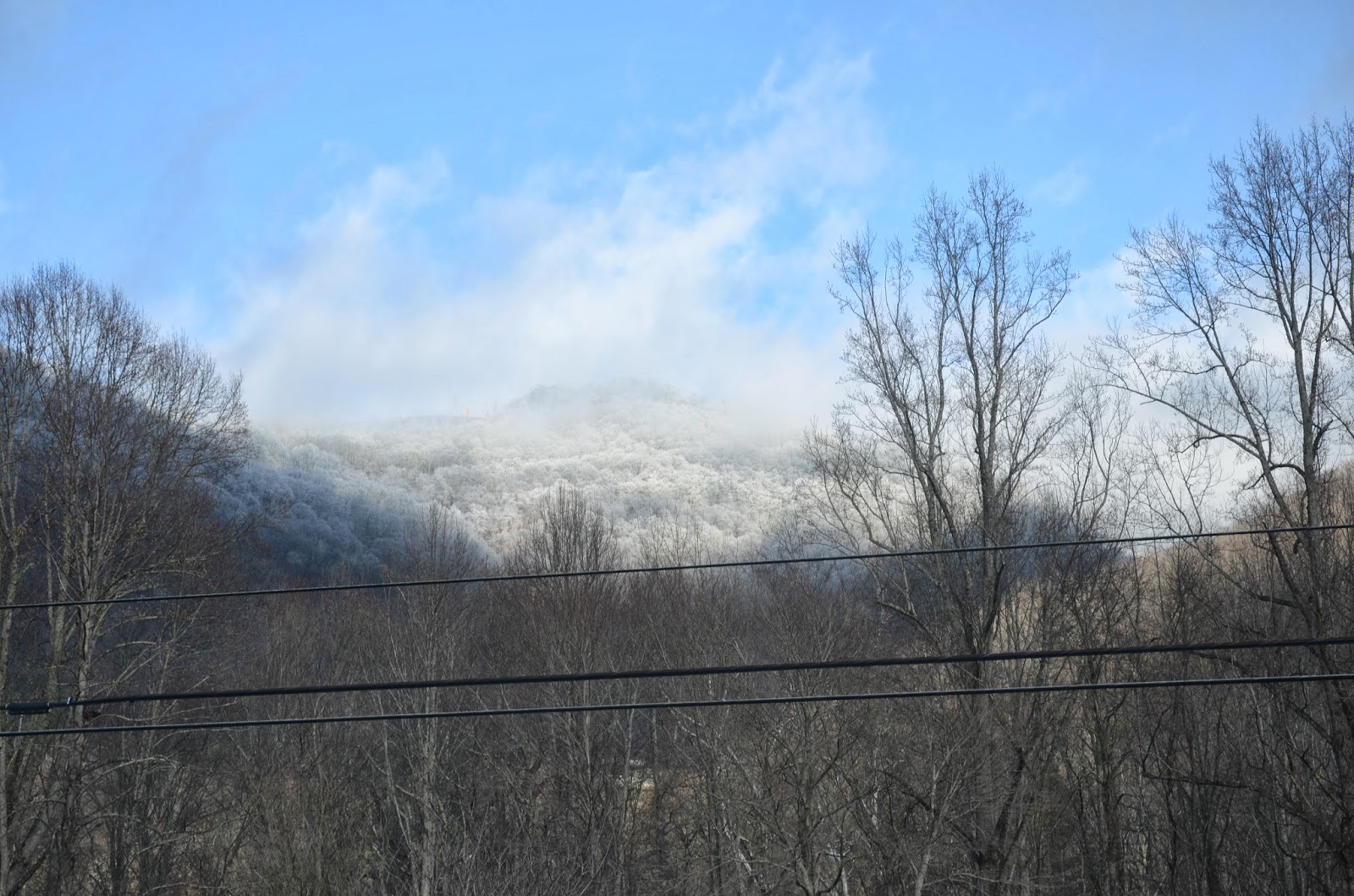
A great place to investigate this proposed project is a large National Forest for its wilderness, ease of access and permission. One of the oldest National Forests in the United States is Pisgah National Forest, located in western North Carolina (Figure 6). Pisgah was founded in 1916 (three years before prohibition) and covers over 500,000 acres of mountainous terrain with an abundance of perennial streams. About one-tenth of Pisgah is old-growth forest (Schaffer 2009), meaning this area was heavily forested during prohibition. In addition, western North Carolina is well known for its high quality moonshine production; both past and present (see the documentary film The Last One).

The project described above would be ideal for a multi-year field school.  But the first step toward bringing a field school on this subject to fruition is to travel to Pisgah and determine the project’s feasibility. Thanks to exploratory funds provided by The Institute for Field Research, the initial trip on December 21, 2013 will provide me and an assistant the opportunity to investigate the feasibility of locating whiskey production sites within the Pisgah National Forest. The immediate focus will be in western McDowell County and southern Haywood County because of their high concentration of old-growth forest (Schaffer 2009).  We also have plans to visit previously recorded still sites as well as meet with several local informants that are well versed in moonshine production.


Figure 6: Map of Pisgah National Forest


References

Curtis, Wayne
2007    Bootleg Paradise.  American Heritage, 58(2).

Huffington Post

Schaffer, Jonathan
2009    Prioritization of Old-Growth Forest Conservation on the Pisgah National Forest. Unpublished Master’s Thesis. Duke University, Durham, NC.